Saturday, April 12, 2014

Cirrus Checkout

The flight school where I teach recently acquired an SR20. In order to be able to instruct in this airplane, one has to complete the Cirrus certified training syllabus. This checkout involves VFR and IFR operations. For VFR, along with showing maneuver proficiency, an emphasis is put on knowing the procedure for deploying the ballistic parachute. Also as part of the CFI checkout is learning which circuit breakers to pull when sitting in the right seat for simulating various failures for students in the left seat. The IFR flights involve all kinds of approaches full/partial panel. Since I wasn't planning on teaching in the SR20 initially I completed the "transition" training so that I could rent and fly the SR20 for fun. I was surprised how roomy the SR20 was inside and how easy it was to adapt to the side stick. The challenge for me was the amount of time the airplane required to slow down from 160 kts for pattern entry. In a C-172, the airplane slows nicely when 10 degrees of flaps are added along with a power reduction abeam the numbers in the downwind. The Cirrus on the other hand requires arrival planning several miles out to get slowed before entering the pattern. Once the SR20 is slowed for the pattern, the speeds are quite higher than other single engine GA airplanes. For example the final approach speed in the SR20 is 80 kts. On the IFR side, the faster speeds take some getting used to. I'm used to C-182 approaches which start at 135 kts, but in the SR20, things happen a lot faster when commencing at 160 kts. It took me several tries to get used to the higher approach speeds.

One other piece of equipment that takes some getting used to is the keypad interface to the G1000. The typical Garmin buttons are still available on the PFD/MFD, but in addition to those, the Cirrus has a keypad that allows full programming of the G1000. My muscle memory still wanted to use the PFD/MFD buttons, but after re-training myself, using the keypad is much more efficient.

G1000 w/keypad
All in all the Cirrus is a fun airplane to fly and am looking forward to taking advantage of the faster cruise speeds for some long distance flights.


Sunday, February 2, 2014

Lake Tour

I recently had a chance to branch out and do some takeoff and landings at some area lakes other than Lake Washington and Lake Sammamish. Thanks to Austin Watson (http://austingwatson.com/aviation) for taking a few hours this afternoon to show me some really cool lakes West of Seattle. One of the highlights was landing at Spencer Lake and being able to dock and walk to the Spencer Lake Bar and Grille.

Route:
From
To
Heading
Totals
Leg
W36
LAKELONG
249°M
15nm
1.9g
0h10m
15nm
1.9g
0h10m
LAKELONG
LAKECUSHMAN
253°M
42nm
5.3g
0h29m
27nm
3.4g
0h19m
LAKECUSHMAN
LAKENAHWATZEL
177°M
57nm
7.2g
0h39m
15nm
1.9g
0h10m
LAKENAHWATZEL
LAKEMASON
57°M
73nm
9.1g
0h49m
16nm
1.8g
9m59s
LAKEMASON
LAKESPENCER
161°M
76nm
9.5g
0h52m
4nm
0.5g
2m33s
LAKESPENCER
LAKETAPS
80°M
108nm
13.3g
1h13m
32nm
3.8g
0h21m
LAKETAPS
W36
335°M
126nm
15.4g
1h24m
17nm
2.1g
0h11m


Fore Flight Map 

Approaching Lake Cushman

On the Ramp at Spencer Lake


.

Wednesday, July 17, 2013

182 Trip to Bozeman, Mt.

This trip is going to take some time to chronicle, but finally had the opportunity to fly our 182 over to KBZN. More to come...

Flightaware Tracking KRNT-KBZN
Snapshot of Weather Between Missoula and Butte One Hour After Landing BZN.  

Butte, MT


Missoula, MT

Near Mulan Pass, ID

Arrival Back in Seattle 2700' OVC

Saturday, June 15, 2013

Pancakes at Desert Aire

I've been flying over to the Desert Air Flyin for several years now and its become one of those annual treks that I look forward to. This year as it turned out, one of my friends (who is also a pilot and used to live in the Pacific NW) was in town. And as is customary, one tries to take a visiting pilot for a fun flight in your neck of the woods. (It's not really customary, but any excuse to fly if you know what I mean). Instead of me journaling the events of the day, David describes it in his own words here.
    

Friday, June 14, 2013

ASES

The floatplane add-on had been on my to-do list and I had been contemplating going to one of the seaplane specialty flight schools and knocking out the rating over a long weekend. As it turned out, the flight school where I have teaching privileges acquired an American Champ Scout (8GCBC). The plane had been on wheels for the winter but as Spring came around the floats were re-installed. The next question, would I be able to instruct on floats after obtaining the add-on? Some of the insurance requirements that I'd heard about required 50, 100 or more hours in type. In this case however, the only insurance requirement was that a designated examiner that was approved by this particular insurance company, sign off with a logbook entry that I was capable and competent to fly with students in the Scout.

N186AC 
In early May I started training in the Scout.The flying part wasn't too bad, but learning not to flare like in a land airplane took some getting used to and all the non-flying logistics like operating the float truck, docking, and moving the plane around the dock were the most challenging. Learning how to read the wind is another art to master and I now find myself noticing all kinds of different wind direction indicators around water. An airplane on floats is a big weather vane and seems to have a mind of its own once the wind starts pushing it around. Lots of forethought into which way to launch, takeoff, land, ramp and dock based on wind conditions are all part of a float pilots repertoire.

So, with 9.2 hours under my belt I scheduled the check ride for the commercial ASES add-on and concurrently would get the instructor sign-off to begin teaching in the Scout. Check ride day started out with wind in the low teens, so the DE and I elected to defer our meeting time a couple of hours as the winds were forecast to drop a bit. The oral part of the check ride started just like all the rest and ends up being more of a discussion than a quiz. The examiner asked me about techniques for docking/beaching and gave me a scenario about docking on a river with some prevailing wind. Our discussion lead to determining what the wind/water current ratio was so that you could decide which one would push the airplane more. The take away was that there is a 5:1 ratio of wind speed to water speed. In other words one knot of water current is equal to 4 knots of wind speed. We then talked about weight and balance of the Scout and based on my calculations the examiner (220 lbs) and me (180 lbs) were just within the envelope on the aft CG side. This lead to a question about stability and he asked, if we have an aft CG, what does that do to stall speed? I hadn't really thought about this subject in a while and like most check rides there's always a discussion question that leads down a path that you aren't prepared for. After drawing a picture of a balancing airplane (CFI candidates will remember doing this) I eventually got to the correct answer.

After the oral, we headed out to the dock and I put the plane in the water while the examiner tied off the plane to the dock. Before cast-off we discussed the various flavors of the W36 Washington One East Channel and West Channel departures. In W36's case it sits at the end of KRNT's runway 16/34 and most of the time take off's are West of the runway 16 center line. But in certain wind conditions, it may be necessary to fly down the runway and join the cross wind departure leg or cross the center line of 16/34 when departing North. We spent some time discussing this and making sure that my intentions (and future student's) are clear to Renton Tower. We then had another discussion about prop safety and he told a story about how a pilot had been killed by a prop strike while docking. In a normal docking scenario, the mixture is set to cutoff as the airplane approaches the dock and then the pilot gets out, hops up on the dock and ties the plane off. In this case the pilot went too far forward on the floats and got hit by the propeller as it wound down. The DE's point was to make sure that you stay clear of the prop while its stopping and the airplane is coasting up to the dock.

The flight was uneventful and I made a series of take offs and landings in mostly rough water conditions. The only surprise was on the last landing when the left window blew open and I thought is was one of those DE induced distractions. Turned out that one of the window latches had vibrated loose, so I secured it and landed normally. The last thing to do was ramp the airplane, load it back on the float truck, and complete the IACRA paper work to issue my temporary pilot certificate with commercial single engine land and sea privileges.

On the Water at Lake Sammamish


Saturday, October 20, 2012

AOPA Summit 2012

I made the trek down to Palm Springs this year for the annual AOPA summit. The goals this year were to look at possible upgrades for the 182 and research the ADS-B and AHRS devices that link with an iPad. Day one of the conference began with the keynote and a panel discussion about some of the international flying adventures the editors of AOPA magazine had made. Though interesting, I think the time could have been better spent talking about the future of GA and the various initiatives that AOPA has for helping that cause. After the keynote I attended a couple of sessions on using the iPad and one on mountain flying.

On day two, the keynote was much more on target with a panel discussion between the editors of Flying Magazine and AOPA Magazine on happenings in GA. Later, Harrison Ford joined the panel for discussion and to describe his role in being a spokesman for general aviation. Most of this day was spent roaming the showroom floor and getting free stuff and interrogating sales types. Though I did attend an interesting session on some real-life stories of controllers who had helped pilots out of various predicaments.

During my adventure on the show floor, I found some items of interest that I'll describe briefly:

  • Lockheed Martin is soon going to go live with their version of online weather briefing (https://lmfsweb.afss.com/Website/). This looks like a  great service and will allow filing and briefing (like duats), but it will be accessible by a briefer over the phone. Unlike filed plans on duats, if you call WX-BRIEF, the briefer will be able to access your flight plan. The new service will also allow the capability to close flight plans via web and the briefing package provides more of the same graphics that the briefer sees when talking to you on the phone. 
  • LogTen Pro (http://coradine.com/) - Until now I had been using an Access database to track flight time, but after seeing the LogTen package for iPad, iPhone, and Mac, I was hooked. Not only can I sync between the three devices, the customization of reports and visible fields is endless. Importing my existing data is also fairly straight forward in that the Mac version allows importing from a CSV and then will map the fields from the CSV to the LogTen database fields that you select. There will be some required tweaking my original data, but it should be minor. For those who don't want to deal with importing on their own, Coradine offers to import your data for free. 
  • Rosen Visors (http://www.rosenvisor.com/) - these guys have been around for a long time and a pair of these versatile vision enhancers has long been on our wish list for the 182. So, finally in a week or two when the package arrives from Oregon, I'll be able to report on how well they work in the 182.
  • AOPA FlyQ - AOPA has ventured into the iPad market with a soon to be released app that judging from the demo that I attended, is a cross between ForeFlight and Wing-X. They've partnered with Seattle Avionics and will support geo-referencing and synthetic vision using a portable AHRS device (see below). The app will be free, but you'll need an annual subscription for charts. I can't wait for the app to hit the iTunes store so that I can give it a try.
  • ADS-B and AHRS for the iPad - There were several vendors present offering an ADS-B and AHRS solution. There wasn't a magic bullet device that worked with all iPad aviation apps so you have to pair the hardware and app. As an example, The Sporty's Stratus is only supported by ForeFlight and ForeFlight doesn't display ADS-B traffic. On the other hand, Garmin has an ADS-B/GPS solution, but it is only compatible with Garmin Pilot. For synthetic vision/attitude, Wing-X seems like the way to go here, until the AOPA Fly-Q app is available.The AHRS device that I was most impressed with was the unit from Levil Technologies which works with Wing-X and Fly-Q. The unit can also be hooked up to ships power and mounted out of site in the cockpit.
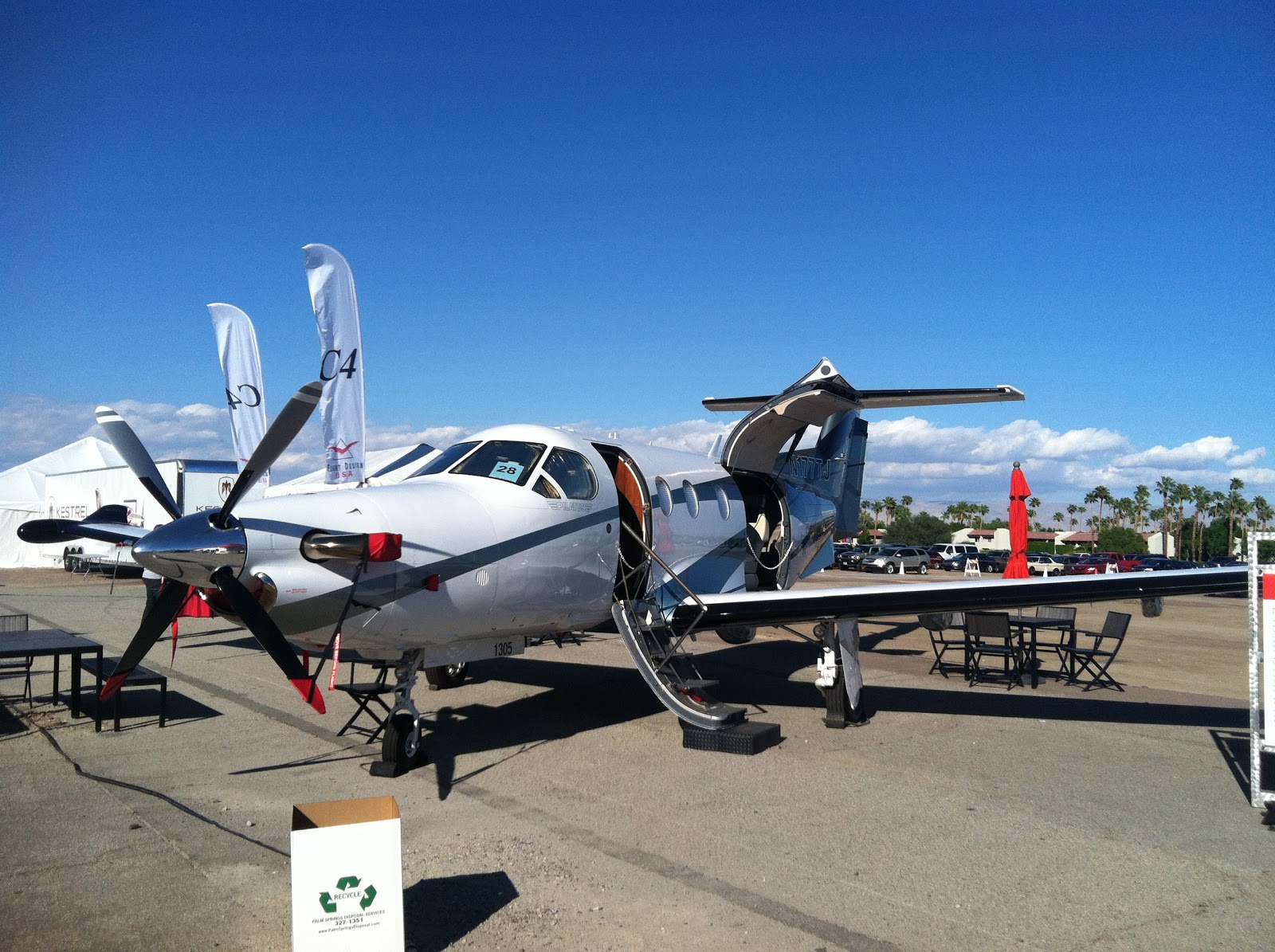
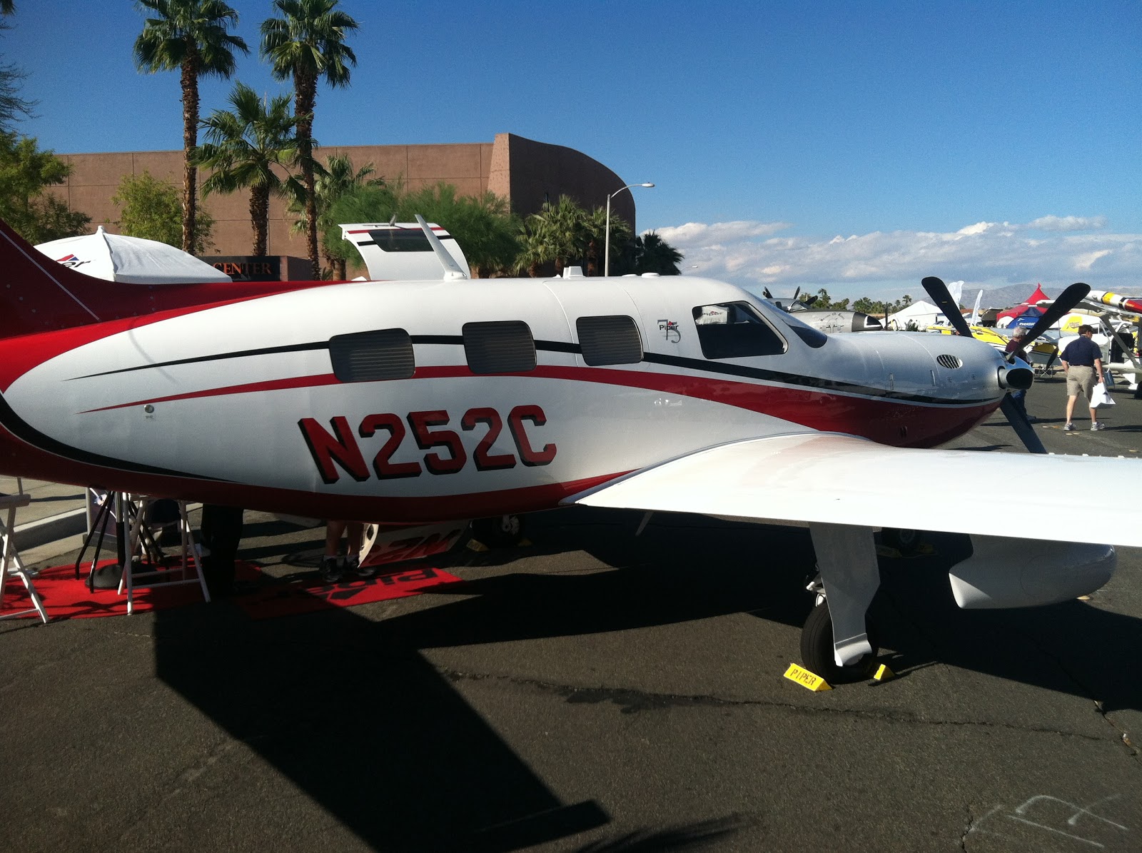
Day three was spent visiting a few booths that needed a second look and to make sure that I hadn't missed any. Also spent some time outside browsing the static airplane displays.


Saturday, September 15, 2012

Ranger Creek

White River Leading to Mt. Rainier
Had a chance this weekend to take the 182 into 21W (topo) with one of the other airplane owners. I'd been to this mountain airport a few  times by car and have camped nearby, but always wanted to experience flying into the airport. It was a calm and fairly sunny day, so I loaded up my survival pack and filed a VFR round robin flight plan; KRNT-21W-KRNT just in case. The flight plan had a two hour time in route so that was plenty of time to get into the canyon and make a few landings with some up close flying near Mount Rainier and return to Renton. After departure we activated the flight plan and headed South East towards Enumclaw to pickup highway 410 which leads right up the canyon along the White River and eventually going to the Sunrise entrance to Mount Rainier National Park.

Approaching Runway 15
The skies were a little hazy due to fires in Eastern Washington, but we found the highway and radome that marks the entry up the mountain pass. The plan was to fly up the pass at 5500' and then drop down to 1500' AGL or so over the runway and get a look for animals, campers, and wind direction. Winds were calm and the runway was clear, so we continued South through the canyon to make a 180 to fly back over the airfield. The canyon is about .7 miles wide at the base and 1.5 miles near the ridge line, so slowing the airplane down for a tight turn is required. With flaps at 20 and 75 kts the 182 negotiated the 180 degree turn in the narrow canyon nicely. After another pass Northbound over the airport, we set up for a landing and went straight in for runway 15. Landing South requires you to make a slight dog-leg as you pass through a quarter mile wide part of the canyon and then picking up the airport as you turn the corner.

The parking off of the runway looked a little dicey with so many rocks, so we shutdown on the runway and took a few minutes to explore and snap some photos. Then it was back in the air for a trip South through the canyon to get some closeups of Mt. Rainier and then back North to setup for one more landing.Following a textbook landing and a long roll to the departure end of runway 33, we turned around and departed to the North and back to KRNT.